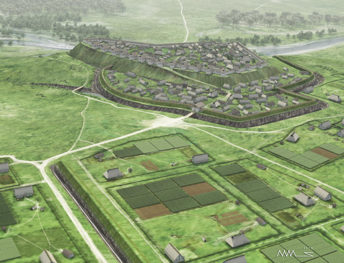
Visualisation of the Heuneburg in the first half of the 6th century BC, as envisioned in 2012 (Graphic: Landesamt für Denkmalpflege im Regierungspräsidium Stuttgart/Markus Steffen, David Maas).
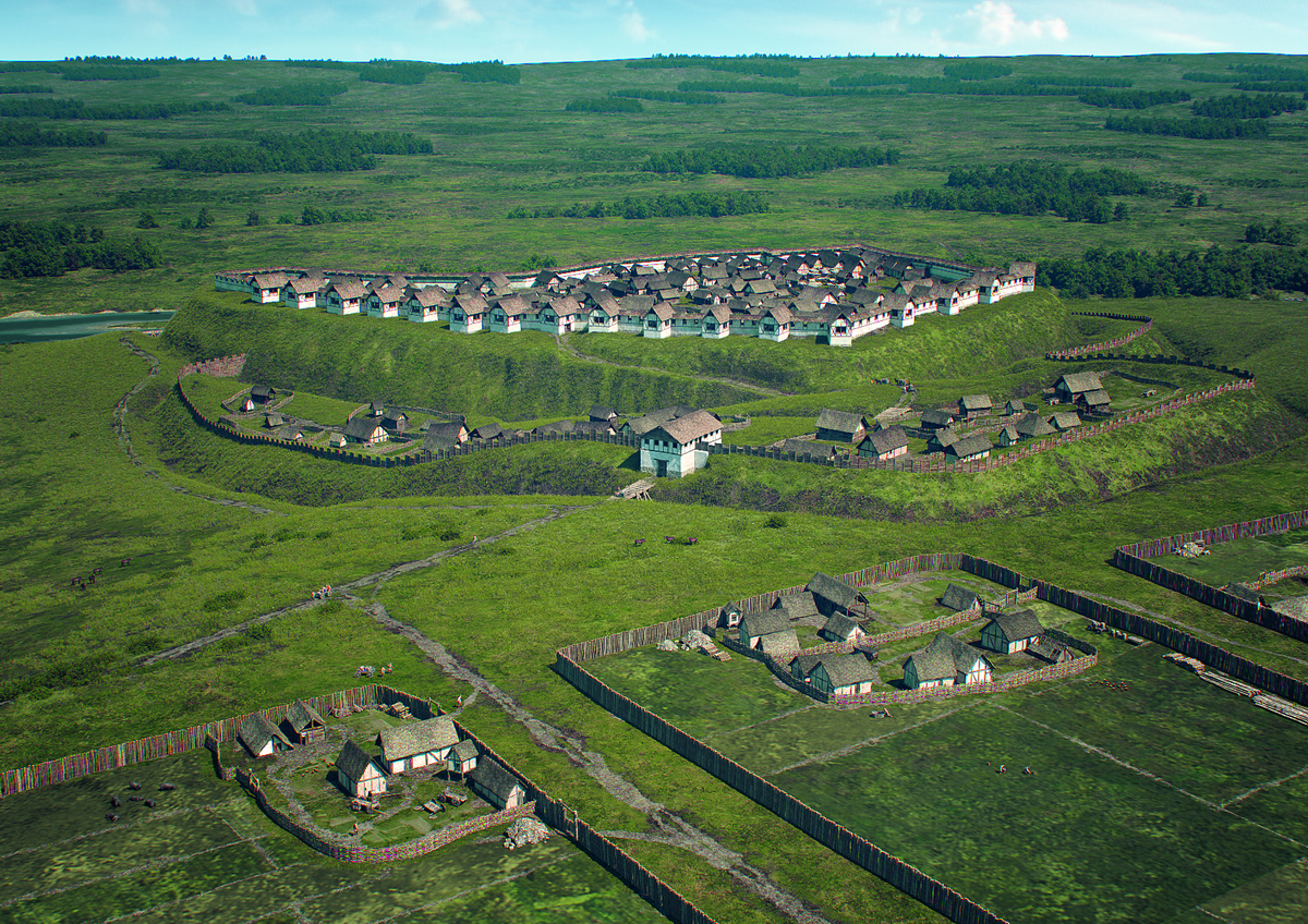
During the time of the mud-brick wall, in the first half of the 6th century BC, the hill-top plateau was densely settled. The population also lived in the expansive outer settlement and lower town (Graphic: Landesamt für Denkmalpflege im Regierungspräsidium Stuttgart/Faber Courtial).
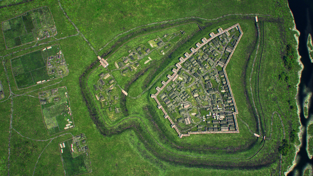
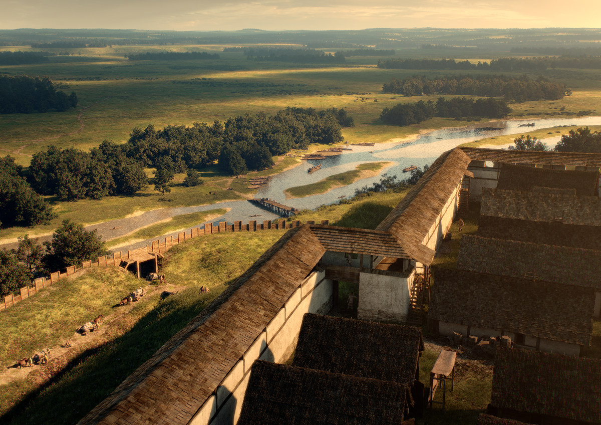
The Heuneburg at its zenith c.600B, with its densely settled upper town, lower town and outer settlement. As envisioned in 2014 (Graphic: Landesamt für Denkmalpflege im Regierungspräsidium Stuttgart/Faber Courtial).
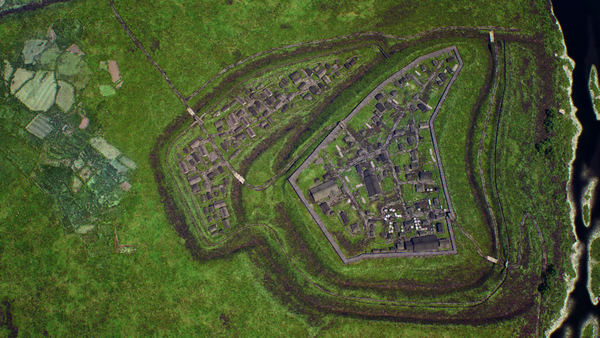
After the destruction of the mud-brick wall c.530 BC, fewer buildings were constructed on the hill-top plateau, whereas the lower town became densely settled (Graphic: Landesamt für Denkmalpflege im Regierungspräsidium Stuttgart/Faber Courtial).
Fortifications
Reconstruction of the mud-brick wall with gangway and gabled roof (Graphic: Landesamt für Denkmalpflege im Regierungspräsidium Stuttgart/Faber Courtial).
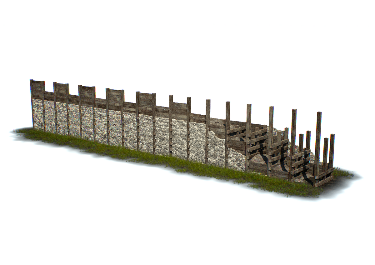
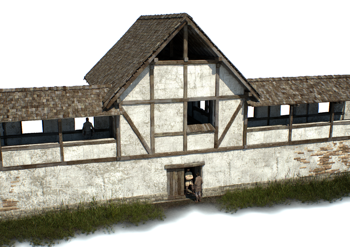
The later fortification, dating to the first half of the 5th century BC, was constructed of vertical timber posts to which horizontal timbers were secured with cross-ties. This frame was in-filled with earth and rubble, and the wall was finished with a face made of chalk (Graphic: Landesamt für Denkmalpflege im Regierungspräsidium Stuttgart/Faber Courtial).
Buildings
Reconstruction of the gatehouse which provided access to the lower town at the time of the mud-brick fortification (Graphic: Landesamt für Denkmalpflege im Regierungspräsidium Stuttgart/Faber Courtial).
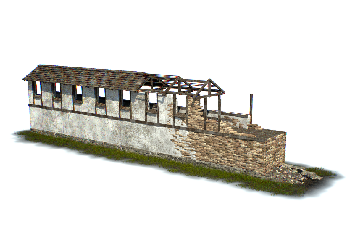
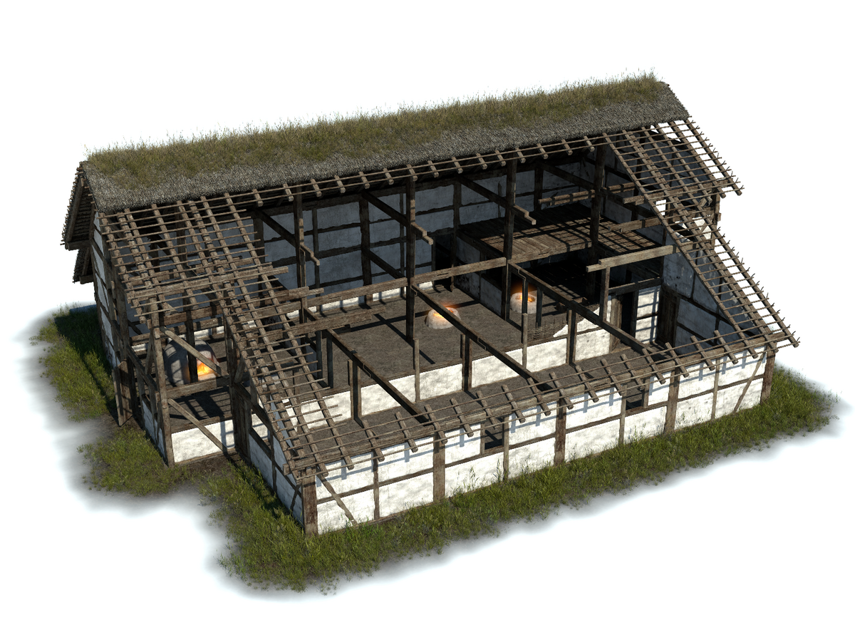
Reconstruction of a large building from the second half of the 6th century BC. This building was located on the Heuneburg's hill-top plateau and had a surface area of over 400 m² (Graphic: Landesamt für Denkmalpflege im Regierungspräsidium Stuttgart/Faber Courtial).
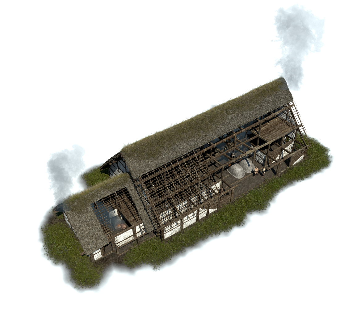
Reconstruction of a large house from the outer settlement. The remains of this building were preserved beneath Barrow 4 of the Gießübel-Talhau necropolis (Graphic: Landesamt für Denkmalpflege im Regierungspräsidium Stuttgart/Faber Courtial).
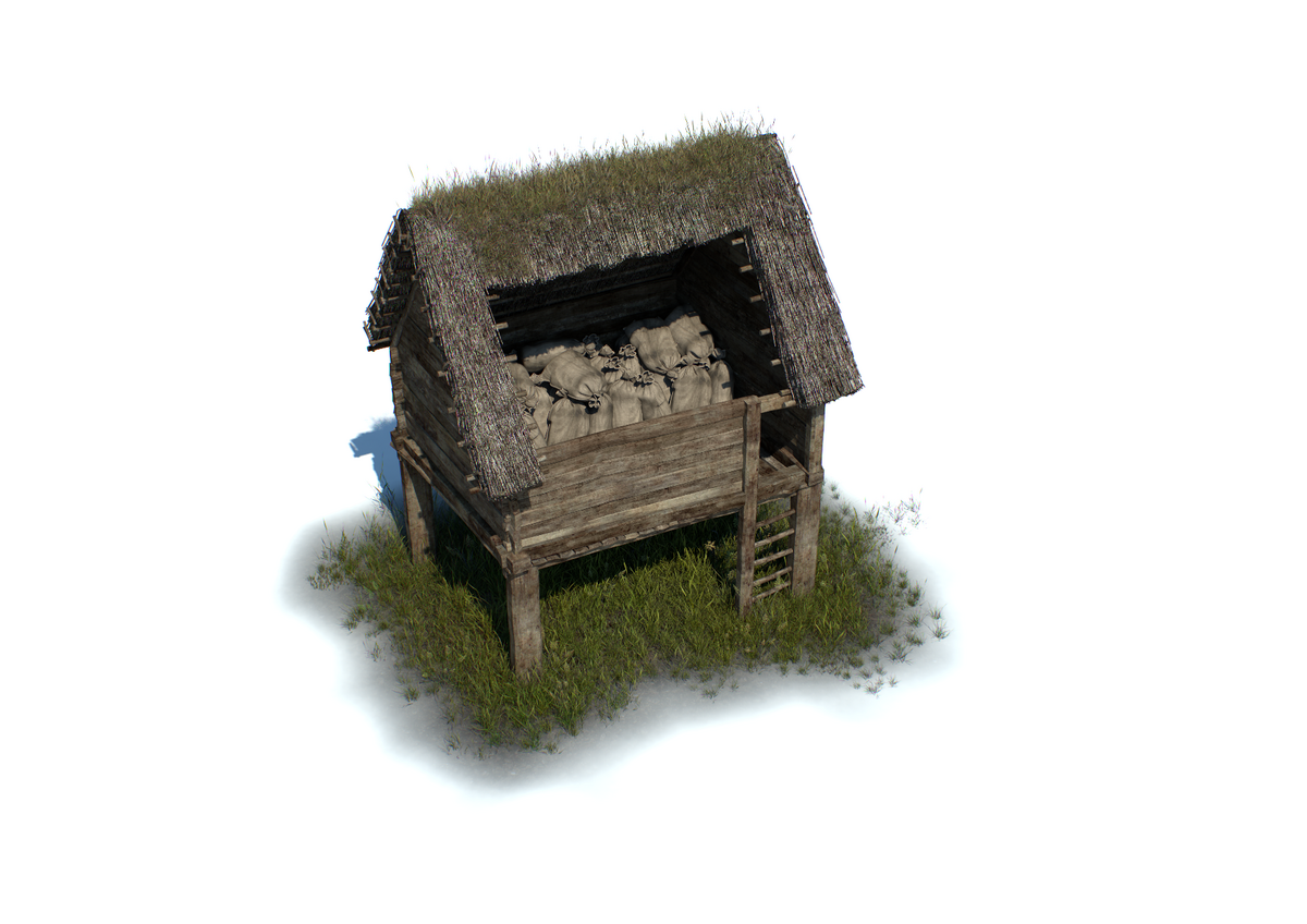
Reconstruction of a four-post storage structure constructed using "Blockenbau" techniques (Graphic: Landesamt für Denkmalpflege im Regierungspräsidium Stuttgart/Faber Courtial).
Views
The construction of the mud-brick wall north of the Alps represented an unparalleled achievement for this region (Graphic: Landesamt für Denkmalpflege im Regierungspräsidium Stuttgart/Faber Courtial).
The impressive gatehouse of the Heuneburg, with the bastions of the mud-brick wall in the background (Graphic: Landesamt für Denkmalpflege im Regierungspräsidium Stuttgart/Faber Courtial).
The densely settled craftmens' quarter in the southern corner of the Heuneburg plateau during the first half of the 6th century BC (Graphic: Landesamt für Denkmalpflege im Regierungspräsidium Stuttgart/Faber Courtial).
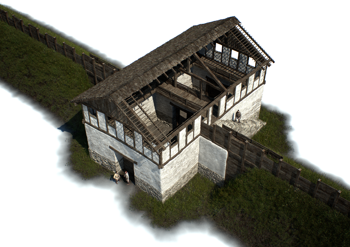
Reconstruction of one of the mud-brick wall's towers, which provided access to the interior of the upper town (Graphic: Landesamt für Denkmalpflege im Regierungspräsidium Stuttgart/Faber Courtial).